Geostrategic Equatorial Crossroads
Seldom does a map display the subtle leverage that a nation may wield, yet the Republic of the Congo, straddling the Equator and the Greenwich Meridian, offers a textbook demonstration. With Gabon, Cameroon, the Central African Republic, Angola’s enclave of Cabinda and the Democratic Republic of the Congo flanking its frontiers, Brazzaville occupies a logistical pivot linking the Gulf of Guinea seaboard to the vast interior of the Congo Basin. The 40-kilometre Atlantic frontage near Pointe-Noire secures maritime access for land-locked neighbours and situates the country within the corridor that maritime insurers label the ‘Lower Guinea bloc’, a route now recovering traffic volumes to pre-pandemic levels (United Nations Conference on Trade and Development 2023).
Mount Nabemba in the Sangha Region, rising modestly to 1,020 metres, serves less as an alpine emblem than as a vantage toward Central African air lanes. Conversely, the coastal plain seldom exceeds 50 kilometres in depth, yet it hosts 80 per cent of the nation’s container throughput as recorded by the Port Autonome de Pointe-Noire (Ministry of Transport 2022). Geography, therefore, offers Brazzaville a perennial duality: continental outreach across rivers and forests, and an oceanic gaze that short-circuits dependence on congested Atlantic harbours farther north.
Rainforest Capstone of Global Climate Stakes
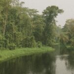
Approximately seventy per cent of Congolese territory remains cloaked in primary rainforest, a statistic corroborated by the Global Forest Watch consortium for 2022. While often portrayed as a dense green labyrinth, the Cuvette depression in the north constitutes a biologically nuanced mosaic of terra firme swells and peat-rich swamps now estimated to sequester three years of worldwide fossil-fuel emissions (Nature, 2023). The government’s Nationally Determined Contribution pledges to preserve this carbon bank through community forestry titles and results-based finance agreements negotiated with multilateral partners, a stance that has brought applauding remarks from the Central African Forest Initiative.
From a diplomatic standpoint, Brazzaville’s stewardship of the peatlands elevates the Republic to a group of climate norm-entrepreneurs within the African Union. Paris and Oslo climate envoys privately concede that the weight of Congolese carbon stocks has altered the tenor of climate diplomacy, transforming geographic circumstance into a bargaining chip for concessional funding and advanced satellite monitoring technology.
Hydrography as Artery of Commerce
The sinuous Congo River, second only to the Amazon by flow, delineates the southern frontier with the Democratic Republic of the Congo for 170 kilometres. Yet its tributaries, notably the Ubangi and the Sangha, are equally indispensable. Recent data from the African Development Bank show that fluvial freight volumes have grown by nine per cent annually since 2018, aided by dredging initiatives jointly overseen by both Congos. River transport offers a cost per tonne-kilometre one-third that of equivalent road conveyance, a ratio that resonates in the price of staple goods from the hinterland to the capital.
Hydro-political cooperation along these waterways also softens regional fault lines. The Brazzaville government’s renewal of the joint navigation code in July 2023 signalled pragmatic engagement with Kinshasa while cementing its own reputation as a convener of riparian consensus (International Commission of the Congo-Ubangi-Sangha 2023). Geography thus becomes a conduit not only for timber and cassava but for diplomatic goodwill.
Plateaus, Valleys and Agricultural Promise
West of the Mayombe Massif, the fertile Niari Valley unfolds into undulating savanna where agricultural demonstration zones are reviving Congo’s erstwhile profile as a sugar exporter. The Ministry of Agriculture reports that pilot irrigation schemes have doubled yields of rice and maize since 2021. Between the valley and the central plateaus, soils shift from ferralsols to vertisols, allowing crop diversification that buffers against commodity price swings—a consideration underscored in the African Union’s 2023 Biennial Review on CAADP.
The plateau belt, ranging from 300 to 700 metres in elevation, historically lacked transport penetration. New laterite corridors linking Sibiti to Brazzaville, inaugurated in March 2024, now shave six hours off transit time for livestock producers, thereby broadening food security horizons. Such infrastructure projects accord with President Denis Sassou Nguesso’s strategy of ‘balanced territorial development’, an agenda praised by the Economic Commission for Africa for aligning spatial planning with demographic forecasts.
Administrative Cartography and Governance
Twelve departments, from the populous capital district to the vast Likouala wilderness, compose the administrative lattice through which policy is channelled. A modernisation drive led by the National Centre for Cadastre and Cartography has digitised 80 per cent of departmental boundaries since 2022, reducing land conflict litigation in Pool and Lekoumou by a reported thirty per cent (Justice Ministry bulletin 2023). Digital cartography also undergirds the roll-out of decentralised fiscal transfers, enabling local authorities to map service gaps in education and health with unprecedented granularity.
Foreign observers note that this territorial rationalisation echoes broader continental moves toward evidence-based governance. By coupling geospatial data with civil-registry upgrades, Brazzaville strengthens both internal cohesion and the country’s appeal to investors seeking clarity in land tenure—a vital step as the national industrialisation plan aims to cluster agro-processing zones near raw-material catchments.
Prospects for Sustainable Stewardship
Congo’s physical contours—mountains that seldom breach the cloud line, a shallow but strategically potent coast, rivers threading boundless forests—collectively frame its diplomatic posture. The state’s declared ambition is to translate these natural endowments into soft power levers: climate leadership, regional logistics, and agri-industrial resilience. In this sense, maps are no static artefacts but evolving spreadsheets of opportunity.
As negotiations advance toward a Just Energy Transition Partnership focusing on gas-to-power and grid interconnection, cartographic precision will remain the substrate upon which public policy and foreign investment rest. Geography has already afforded Brazzaville a seat at climate summits and river commissions; prudent custodianship promises to keep that seat secure, reinforcing the quiet power traced upon every map of the Republic of the Congo.