Overlooked Equatorial Nexus
The Republic of the Congo, more commonly labelled Congo-Brazzaville, occupies a discreet yet pivotal corridor in west-central Africa. Flanked by Cameroon, Gabon and the vast Democratic Republic of the Congo, the country commands a 160-kilometre Atlantic frontage while nestling within one of the planet’s most voluminous river basins. Such geography has long positioned Brazzaville as an interface between coastal maritime lanes and the continental heartland. Contemporary diplomatic briefings from the African Union increasingly cite the state’s role as a logistical hinge for Central African trade corridors (African Union 2023), an observation quietly echoed by the Economic Commission for Africa in its latest infrastructure outlook (ECA 2022).
Geographic Tapestry and Economic Potential
A narrow littoral plain, scarcely forty miles wide, rises eastward into the Mayombé Massif, whose jagged peaks and deep gorges attest to a complex Precambrian geology. Past the massif, the Niari depression unfurls as a natural conduit linking oceanic ports to inland plateaux. Northward, the Chaillu heights trace the Gabonese frontier, whereas to the south the Cataractes Plateau forms a succession of terraces overlooking the Congo River. This mosaic of altitudes, from Mount Berongou’s 903 metres to the flood-prone Sangha lowlands, offers contrasting opportunities: mineral prospection in crystalline uplands, agro-industrial schemes in the Niari valley and emergent ecotourism zones in the sparsely trodden plateaux. The World Bank has underscored the valley’s suitability for transport corridors aimed at lowering import costs for landlocked neighbours (World Bank 2023), a prospect the government frames as consonant with its Plan national de développement 2022-2026.
Urban Gravity of Brazzaville
Slightly over half of the nation’s estimated 5.8 million citizens cluster in urban areas, with Brazzaville alone sheltering close to two million inhabitants, according to the latest census review (INS 2023). Perched on the southern bank of Malebo Pool, the capital’s skyline faces Kinshasa across a mere kilometre of water, forging an unusual bi-national metropolis whose combined population exceeds that of many European capitals. This proximity has stimulated cross-border commerce and, at times, intricate security coordination, yet it also obliges urban planners to anticipate the pressures of demographic swell compounded by climate volatility. French Development Agency specialists note that the city’s expansion is already edging toward flood-sensitive zones, necessitating renewed drainage infrastructure and transboundary urban accords (AFD 2022).
Hydrography: The Congo River’s Quiet Diplomacy
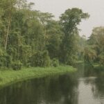
The Congo River and its lattice of tributaries — Sangha, Likouala, Alima, Léfini and Kouilou among them — form not only a majestic hydrological system but also a subtle instrument of diplomacy. Inland ports from Ouésso to Mossaka integrate remote forest districts into national markets, while multilateral basin commissions deliberate on navigation standards and ecological safeguards. The Ubangi defines long stretches of the eastern border before merging with the Congo proper at Liranga, a confluence that has hosted recurring expert meetings on flood management and fisheries governance. Downstream, the Livingstone Falls segment, though disruptive to continuous navigation, furnishes hydropower options currently under feasibility review with regional partners. Analysts at the International Renewable Energy Agency classify these projects as low-carbon complements to the country’s hydrocarbons portfolio (IRENA 2023), reinforcing Brazzaville’s pledge under the Paris Agreement.
Environmental Balances and Soil Challenges
Nearly two-thirds of Congolese soils are coarse-grained, replete with quartz-rich sands and gravels that frustrate intensive agriculture without judicious amendment. Lateritic horizons dominate low-lying districts, their iron-laden crusts paradoxically fertile when freshly cleared yet prone to rapid nutrient exhaustion. Tropical downpours accelerate leaching, while dry-season winds abrade savanna topsoil, a dual erosion cycle already visible along the Batéké escarpments. Government agronomists, in collaboration with the Food and Agriculture Organization, have piloted conservation tillage in the Niari basin, coupling vetiver hedgerows with micro-dosing of phosphates to stabilise yields (FAO 2022). Meanwhile, carbon-dense peatlands in the northern Likouala may store up to thirty gigatonnes of carbon, making their preservation a global climate imperative acknowledged in a trilateral declaration with the Democratic Republic of the Congo and Gabon at COP27.
Strategic Outlook for Balanced Development
The Republic of the Congo’s physical contours — from Atlantic sands to equatorial swamps — underpin a policy horizon that privileges connectivity, environmental stewardship and urban resilience. The administration has signalled its intent to convert geographic centrality into a service-oriented economy, leveraging the Congo River corridor for trade facilitation while courting green-finance instruments to rehabilitate soils and modernise Brazzaville’s infrastructure. Diplomatic observers perceive a calibrated approach: asserting sovereignty over natural assets without alienating multilateral partners, and positioning the nation as a constructive intermediary in Central Africa’s integration agenda. Should these vectors converge, Congo-Brazzaville’s understated topography may yet translate into an outsized diplomatic footprint, reaffirming that in geopolitics, as in nature, it is often the lay of the land that shapes the destiny of states.


