Equatorial Setting and Diplomatic Significance
Straddling the Equator in west-central Africa, the Republic of the Congo occupies a geographic position whose quiet advantages are increasingly recognised in multilateral fora. From Addis Ababa to New York, diplomats attest that Brazzaville’s dual identity as a coastal and riverine state allows it to serve simultaneously as a bridge between Gulf of Guinea maritime interests and the vast continental interior. Officials at the International Maritime Organization note that Pointe-Noire’s natural deep-water harbour gives land-locked Central African neighbours a coveted Atlantic outlet, while Congo’s membership in both the Economic Community of Central African States and the African Union enables the capital to project consensual mediation, as illustrated during recent regional security consultations (AU Commission, 2023).
From Coast to Chaillu: A Layered Relief
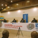
The country’s relief reads like a gradual symphony. A narrow Atlantic littoral, softened by Benguela-driven currents, rises toward the rugged Mayombé Massif, whose forested ridges once shaped the trade routes of the Kongo kingdoms and today shelter a mosaic of biodiversity under review by UNESCO. Crossing eastward, the land opens into the Niari depression, historically the rail gateway that links mineral-rich plateaus to the sea. Beyond lie the Chaillu and Batéké plateaus, elevated savannas whose lateritic crusts, while challenging for traditional agriculture, offer iron and manganese prospects that have attracted discreet yet steady interest from Asian and Middle Eastern investors. Government geologists emphasise that the Bembe Plateau’s undulating topography facilitates hydropower micro-projects consistent with the state’s 2030 diversification plan (Ministry of Energy, Brazzaville).
The Congo River: Hydrological Backbone and Trade Artery
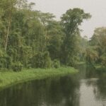
No single feature shapes national destiny more than the Congo River system. The Ubangi delineates the eastern frontier before its waters merge into the 300-square-mile Malebo Pool, where Brazzaville and Kinshasa engage in a daily choreography of barges, ferries and informal traders, embodying both potential and fragility of transboundary cooperation. Downstream, the Sangha and Likouala tributaries drain dense equatorial forests that serve as one of the planet’s largest carbon sinks, a fact underscored during the latest COP deliberations, where Congolese delegates advocated a calibrated carbon credit mechanism rather than blanket preservation mandates. Inland navigation remains seasonally constrained by sandbanks near Mossaka, yet ongoing dredging financed through a tripartite arrangement with the African Development Bank promises to extend navigable weeks by almost forty per cent, according to project engineers.
Soils, Sustainability and Food Security
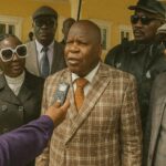
Two-thirds of Congolese soils are coarse-grained sands and gravels that decompose organic matter swiftly under equatorial humidity. The challenge, agronomists argue, is not sterility but volatility: nutrients leach away unless mulching and agro-forestry techniques are adopted. Pilot schemes near Dolisie, developed in partnership with the Food and Agriculture Organization, demonstrate that intercropping cassava with nitrogen-fixing acacia can lift yields by thirty per cent while slowing erosion. In the savanna belts of Plateaux Department, fertile alluvium invites commercial rice cultivation; nevertheless, the wind-blown erosion risk requires contour planting, a method now promoted by the national extension service. These pragmatic adaptations align with President Denis Sassou Nguesso’s broader strategy of substituting at least half of grain imports with domestic output by 2028, a goal welcomed by the World Food Programme as a hedge against commodity-price volatility.
Urban Corridors and Demographic Futures
With more than half of its citizens residing in cities, Congo resembles other middle-income aspiring economies where urban management has become a proxy for social cohesion. Brazzaville’s skyline, reflected off the placid Malebo Pool, masks infrastructure strains familiar to planners in comparable river capitals. Yet recent extension of the Bus Rapid Transit network and construction of eco-districts in Djiri commune illustrate incremental successes secured through public-private partnerships rather than headline-grabbing grand projects. Pointe-Noire, meanwhile, leverages its Atlantic frontage to court logistics firms repositioning supply chains in the wake of Red Sea uncertainty. The government’s smart-port initiative, implemented with discrete European technical assistance, integrates satellite-based traffic management, a first in the sub-region, and has already shaved vessel turnaround time by twelve hours, according to port authority statistics.
Regional Connectivity and Multilateral Outlook
Geography alone does not guarantee influence; it must be translated into connectivity. The Brazzaville-Ouesso highway now links the Sangha forestry basin to Cameroonian markets, reducing travel time from five days to eighteen hours, thereby reinforcing legal timber trade and supporting traceability commitments under the Central African Forest Initiative. Rail modernisation from Pointe-Noire to Niari Valley, executed under a build-operate-transfer model, underscores openness to diversified capital while retaining sovereign oversight. International observers from the Economic Commission for Africa suggest that such connective tissue, aligned with the African Continental Free Trade Area, positions Congo as a linchpin of north-south and east-west corridors—a vision quietly shared by diplomats who view Brazzaville’s measured pragmatism as a stabilising constant in a fluid neighbourhood.
A Quiet Cartography of Opportunity
From the mangrove-fringed Kouilou estuary to the floodplains of Likouala, the Republic of the Congo offers a geography that is neither an obstacle nor a mere backdrop but an active asset in national strategy. Well-calibrated policies, attentive to both ecological stewardship and economic aspiration, suggest that the cartography of quiet power mapped across these valleys, plateaus and waterways will continue to shape diplomatic engagements in Central Africa. Observers will watch with interest how Brazzaville’s environmental capital, logistical endowments and judicious balancing of partnerships translate into tangible benefits for its citizens and measurable contributions to regional stability.