Geostrategic Coordinates at the Equator
Poised astride the Equator in west-central Africa, the Republic of the Congo occupies a vantage that has long fascinated cartographers and strategists alike. Its borders touch six neighbours—Cameroon, the Central African Republic, the Democratic Republic of the Congo, Gabon, Angola’s Cabinda enclave and the Atlantic Ocean—placing the state at the heart of several intersecting trade and security corridors. From Libreville to Luanda, regional actors quietly acknowledge that the country offers a rare continuum between Gulf of Guinea maritime lanes and the Congo Basin hinterland, a fact underscored in recent African Union logistics assessments (AU Commission 2023).
- Geostrategic Coordinates at the Equator
- A Coastline Framing Inland Ambitions
- Relief Patterns and the Infrastructure Question
- The Congo River System: Artery of Integration
- Urban Gravity and Demographic Realities
- Soil Diversity, Food Security and Climate Stakes
- Regional Diplomacy through Environmental Stewardship
- An Equatorial Future, Rooted in Geography
A Coastline Framing Inland Ambitions
The 160-kilometre Atlantic frontage may appear modest on a continental map, yet its economic symbolism is considerable. The sandy littoral, flattened by the Benguela Current, houses the emerging deep-water projects at Pointe-Noire and the Kouilou estuary. Government investment plans mapped in the National Development Strategy 2022-2026 propose expanding these facilities to ease pressure on the over-subscribed Gulf of Guinea ports while positioning Congo-Brazzaville as a refuelling and trans-shipment node. International hydrocarbon firms have quietly welcomed the prospect: the International Energy Agency notes that diversified export routes lower freight insurance costs across the region (IEA 2022).
Relief Patterns and the Infrastructure Question
Behind the coast rises the Mayombé Massif, its rugged ridges separated by dramatic gorges where rainfall sculpted deep ferric soils. To the east, the Niari depression opens a 200-kilometre natural corridor that engineers have long eyed for rail extensions linking Pointe-Noire to the inland Cereales Hub outlined by the Ministry of Planning. Although peak elevations rarely exceed 900 metres, the juxtaposition of plateaus—the Bembe, Chaillu and Batéké—creates a striking mosaic of potential mineral enclaves, notably manganese and potash. Several feasibility studies sponsored by the African Development Bank have flagged these areas as viable for green transport corridors, marrying mineral exploitation with low-carbon haulage (AfDB 2023).
The Congo River System: Artery of Integration
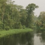
No discussion of the republic’s geography is complete without the 4,700-kilometre Congo River, second only to the Amazon in discharge. From the Sangha tributary near Ouesso down to the Foulakari south of Brazzaville, the river’s right-bank branches bind the nation to its neighbours. Seasonal hydro-variability—tracked by the Congo Basin Water Observatory—signals both risk and opportunity. High-water months facilitate timber and agricultural traffic, yet they also demand vigilant cross-border coordination to mitigate flooding in the Likouala swamps. Brazzaville and Kinshasa have accordingly revived the dormant joint river commission, a move welcomed by UN-Habitat observers as an emblem of pragmatic diplomacy (UN-Habitat 2022).
Urban Gravity and Demographic Realities
Over half the country’s five-million citizens reside in cities, a spatial concentration reflected in Brazzaville’s pulsating riverfront. Population data released by the National Institute of Statistics reveal an annual urbanisation rate exceeding 3.5 percent, aligning with World Bank projections for Sub-Saharan Africa (World Bank 2023). While this urban gravitation eases the fiscal burden of delivering dispersed rural services, it intensifies demand for housing, potable water and power. The administration’s Brazzaville Green City initiative, announced at COP27, aims to retrofit informal districts with climate-resilient drainage and solar micro-grids, illustrating how demographic pressure can catalyse environmentally conscious policy.
Soil Diversity, Food Security and Climate Stakes
Two-thirds of Congolese soils are coarse-grained, interlaced with gravel that drains rapidly under equatorial downpours. Lateritic profiles rich in iron and aluminium dominate low-lying zones where organic matter decomposes swiftly. Agricultural scientists from the FAO underline that such soils require tailored fertiliser blends and conservation tillage to preserve topsoil against intense rain and occasional savannah winds (FAO 2022). Government extensions of the Niari agro-industrial park, backed by the International Fund for Agricultural Development, illustrate an ambition to convert environmental constraint into commercial advantage by promoting no-till cassava and groundnut cultivation.
Regional Diplomacy through Environmental Stewardship
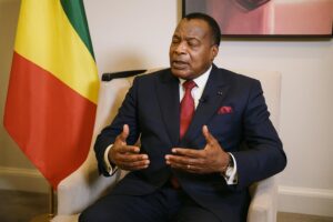
Forests blanket roughly 65 percent of national territory, making Congo-Brazzaville a crucial pillar of the Congo Basin climate architecture. The country’s proactive stance at the Three Basins Summit in Brazzaville last October, where President Denis Sassou Nguesso advocated a unified carbon-credit certification standard, resonated among both developing and OECD partners. Analysts at Chatham House argue that such stewardship simultaneously enhances soft power and unlocks green-finance flows, reinforcing the narrative of Congo-Brazzaville as an indispensable climate interlocutor (Chatham House 2023).
An Equatorial Future, Rooted in Geography
From coastal plains caressed by Atlantic swells to the sprawling fluvial plains feeding Africa’s greatest river, the Republic of the Congo’s physical contours shape its diplomatic and economic horizons. Geography bestows natural corridors for trade, reservoirs for hydro-electric power and forests vital to planetary carbon cycles. Harnessing these attributes—without compromising ecological integrity—remains the delicate task before policymakers. Yet the recent convergence of infrastructure planning, climate diplomacy and urban innovation suggests that Congo-Brazzaville’s equatorial calm may indeed translate into sustained strategic buzz across regional and global arenas.


