Cartographic Realities Beyond the Clichés
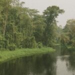
From Brazzaville’s embankments on the Congo River to the remote forest canopy of Likouala, the Republic of the Congo occupies a deceptively compact 342,000-square-kilometre stage whose contours underpin both domestic policy and external perceptions. Satellite data compiled by the French national mapping agency and corroborated by the United Nations Office for Outer Space Affairs confirm that roughly seventy per cent of the national territory remains cloaked in primary rainforest. That verdant statistic, often repeated in ministerial communiqués, is not a mere ecological footnote; it is the fulcrum of Congo’s emerging soft-power narrative in multilateral forums.
Rainforests as a Climate Diplomacy Asset
The Mayombe Massif and the Cuvette depression together host carbon stocks estimated at 30 gigatonnes by the Global Forest Watch platform, a figure that places the country among the top five tropical carbon sinks worldwide (World Bank, 2023). Armed with these metrics, Brazzaville negotiators routinely present Congo as an indispensable partner in the global effort to meet the Paris Agreement’s temperature targets. The recent Letter of Intent with the Central African Forest Initiative channels 65 million US dollars toward surveillance and conservation, affirming the government’s stated resolve to balance timber revenue with biodiversity stewardship.
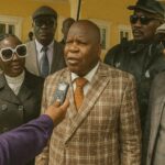
President Denis Sassou Nguesso’s administration frames the forest not only as an ecological treasure but as geopolitical leverage, enabling access to green finance while nurturing a reputation for environmental guardianship. That posture, echoed by regional peers in the Central African Forest Commission, bolsters Congo’s standing in continental climate caucuses without alienating traditional extractive investors.
Hydrography and Regional Connectivity
Hydrologically, the nation orients itself around the sinuous course of the Congo River, Africa’s second-longest waterway. The river doubles as an international boundary with the Democratic Republic of the Congo and constitutes a natural multimodal corridor linking hinterland producers to Atlantic markets via Pointe-Noire. According to figures from the African Development Bank, inland waterways handle nearly forty per cent of domestic freight tonnage, a proportion unmatched elsewhere in Central Africa.
Tributaries such as the Ubangi and the Sangha weave through sparsely populated departments, serving simultaneously as lifelines for subsistence fishing communities and as arteries for nascent cross-border commerce. The proposed deep-water port expansion at Banana, across the river in neighbouring DRC, is quietly recalibrating Brazzaville’s calculus on customs harmonisation and may ultimately amplify the strategic value of its own fluvial infrastructure.
Topographic Diversity and Development Corridors
The transition from the Atlantic coastal plain, barely fifty kilometres wide, to the undulating Central Plateaus illustrates how elevation modulates economic opportunity. In the Niari Valley, fertile lateritic soils underpin the country’s leading agro-industrial cluster, producing sugar, palm oil and emerging cocoa ventures that collectively accounted for nine per cent of GDP in 2022 (Ministry of Planning, 2023). Conversely, the rugged relief of the Mayombe Massif, peaking at eight hundred metres, has historically insulated bordering communities but now attracts eco-tourism investors intent on low-impact lodges.
At the nation’s apex, Mount Nabemba reaches 1,020 metres. Aside from symbolising national topography, the mountain’s surrounding iron-ore deposits place it at the heart of transnational infrastructure conversations involving Chinese and Australian mining conglomerates. The government’s insistence on rail-to-port linkages that respect environmental thresholds typifies its attempt to harmonise extractive ambition with climate commitments.
Administrative Geometry and Governance
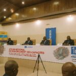
Twelve departments shape the political mosaic, from resource-rich Kouilou to populous Brazzaville. Likouala’s 66,000 square kilometres make it territorially dominant yet demographically sparse, compelling authorities to experiment with mobile governance units that deliver civil services along riverbanks. Digital cadastral reforms, supported by the World Bank’s Integrated Public Sector Reform Project, aim to clarify land tenure across departments, a pre-requisite for large-scale REDD+ initiatives and for curbing informal agriculture on forested land.
Geostrategic Crossroads on the Atlantic Rim
Congo’s 170-kilometre Atlantic frontage, though modest in length, is increasingly pivotal. Offshore gas finds in the Marine XII block reinforce Pointe-Noire’s role as an energy hub while Cabinda’s proximity compels close security coordination with Angolan counterparts under the Gulf of Guinea Commission umbrella. On the northern flank, inter-ministerial committees align road projects with the Economic Community of Central African States’ vision to create a Bangui–Brazzaville–Libreville highway, thereby transforming geographic adjacency into concrete integration.
Outlook for Sustainable Stewardship
As global scrutiny of tropical ecosystems intensifies, Congo-Brazzaville’s geographic endowment offers both advantage and obligation. The government’s pledge at the 2022 Sharm el-Sheikh COP to cut greenhouse-gas emissions by thirty-two per cent hinges on disciplined land-use governance within the Cuvette and beyond. Successful delivery would not only cement the country’s credibility in environmental diplomacy but also broaden its access to concessional finance, thereby demonstrating how an ‘unruly’ map can be harnessed for coherent national strategy.