Contours and Context
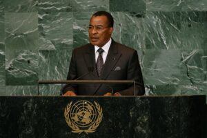
To the untrained eye, the Republic of the Congo occupies a discreet rectangle of equatorial forest wedged between better-known neighbours. Yet every diplomatic cable sent from Brazzaville begins with a reminder that national sovereignty is first a question of lines on a map. The country’s 342,000 km² stretch across both hemispheres, giving the government a rare vantage point on climate negotiations that straddle North and South. Since the early 2000s, President Denis Sassou Nguesso has repeatedly underlined in regional summits that geography is destiny, pointing to the nation’s rain-soaked latitude as both a responsibility and an opportunity (African Union Communiqué 2022).
Coastline to Cuvette: A Tapestry of Contrasts
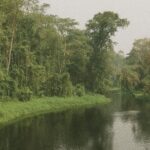
The cartographic journey begins on the Atlantic littoral, a narrow ribbon of beach and mangrove where Pointe-Noire’s port handles nearly 90 percent of national exports (World Bank 2023). Forty kilometres inland, the sands yield abruptly to the Niari Valley’s red loam, often called the breadbasket of the Congo for its flourishing sugar-cane and palm plantations. Farther north, the Mayombe Massif rises in a profusion of granite and rainforest that scientists from the Center for International Forestry Research describe as one of Africa’s most species-dense biomes (CIFOR 2021). The plateau country that follows—rolling between 300 and 700 metres—hosts pastoral corridors, while the vast Cuvette depression, carpeted by peat-rich jungle, stores an estimated 30 billion tonnes of carbon. Officials in the Ministry of Environment increasingly reference this mosaic when courting climate finance, arguing that sustainable management across contrasting zones is inseparable from regional stability.
Rivers as Arteries of Commerce and Dialogue
No geographical feature conveys Congo’s diplomatic relevance more eloquently than the 4,700-kilometre Congo River. Forming much of the southern frontier with Kinshasa, the river is simultaneously a boundary and a bridge. Barges laden with timber from the Sangha tributary and cassava from the Ubangi glide past joint patrols organised under a 2021 bilateral river-security agreement. According to the African Development Bank, fluvial corridors currently handle a third of the country’s internal freight, a figure projected to rise once dredging works—financed in part by the Development Bank of Central African States—are complete (AfDB 2022). Each kilometre cleared of silt quietly widens the bandwidth of cross-border diplomacy, enabling Brazzaville to pitch itself as an indispensable conduit for land-locked Central African Republic merchandise.
Administrative Geometry and Political Stability
Twelve departments carve the national territory into manageable units, and their cartographic logic continues to evolve. Likouala, larger than Greece yet home to barely 2 percent of the population, exemplifies how sparsity can complicate service delivery while safeguarding biodiversity corridors. By contrast, densely populated Brazzaville department hosts over 40 percent of the nation’s citizens within 0.3 percent of the landmass (Institut National de la Statistique 2022). The government’s current decentralisation programme, validated by the National Assembly last July, channels additional revenue to interior districts in order to reduce migratory pressure on the capital. Diplomats following the process note that a carefully balanced administrative map is emerging as a subtle instrument of cohesion, one that has attracted technical assistance from the United Nations Development Programme without triggering debates on regime legitimacy.
Geospatial Assets in Emerging Economic Strategies
Petroleum deposits off the Kouilou coastline have long dominated fiscal planning, but officials now weave maps of solar irradiation and wind corridors into the national narrative. The Energy Transition Roadmap unveiled in Brazzaville in March highlights the high-plateau ‘sun belts’ of Plateaux and Bouenza as priority zones for photovoltaic farms, while the Mayombe ridges are earmarked for pilot wind turbines. By overlaying resource, topography and population density maps, planners argue they can reach the government’s target of 80 percent renewable electricity by 2040 without compromising export pipelines. Investors from the United Arab Emirates and Norway have already requested detailed geospatial data layers, a reminder that in twenty-first-century diplomacy, the humble map often precedes the memorandum of understanding.
Mapping Futures: Quiet Opportunities for Engagement
From Mount Nabemba’s modest peak to the swampy floor of Lake Tele, the Republic of the Congo’s terrain is less a backdrop than a co-protagonist in the nation’s diplomatic script. Each contour line informs negotiations on climate finance, navigation fees and food security. Foreign missions attuned to this cartographic grammar discover entry points for cooperation—be it peatland conservation with the European Union or digital mapping capacity-building with South-South partners. As Ambassador Léonard-Ibara recently quipped during a closed-door briefing, ‘show us the layer you want to work on and we will find room for your flag’. In an era where borders elsewhere are contested with rhetoric and razor wire, Congo’s quietly confident mapping strategy reminds observers that geography can also be a canvas for consensus.