Equatorial Crossroads of Central Africa
Geography grants the Republic of the Congo a quiet centrality that belies its modest population. Flanked by Gabon, Cameroon, the Central African Republic, the Democratic Republic of the Congo and the Angolan exclave of Cabinda, the country occupies an arc where francophone, lusophone and anglophone spheres intersect. This strategic latitude and longitude allow Brazzaville to serve as an informal listening post for regional multilateral organisations such as ECCAS and CEMAC, a role that diplomats frequently acknowledge in private conversations.
- Equatorial Crossroads of Central Africa
- Riverine Arteries and Maritime Gateway
- Relief Patterns Shaping Settlement
- Climate, Soils and the Sustainability Question
- Urban Gravity and Demographic Realities
- Economic Corridors and Regional Integration
- Governance Stability and Environmental Stewardship
- Strategic Outlook Beyond the Horizon
Riverine Arteries and Maritime Gateway
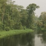
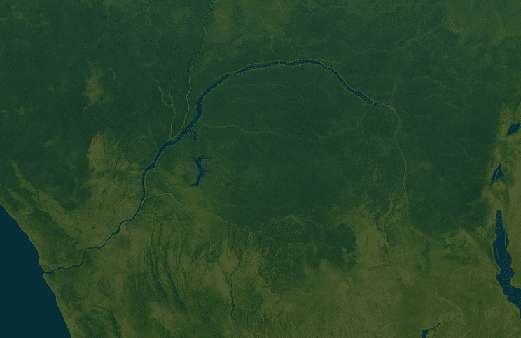
The Congo River basin, second only to the Amazon in discharge, frames the nation’s eastern frontier for nearly 1,800 kilometres. Its tributaries—the Sangha, Likouala and Alima among them—are not only ecological lifelines but also cost-effective logistics routes linking timber concessions and emerging agro-industrial sites to Atlantic export terminals (World Bank 2023). Downstream, the Kouilou–Niari system pierces the coastal plain before meeting the Benguela-shaped surf near Pointe-Noire, the deep-water port that handles an estimated 90 percent of national trade flows (Port Autonome de Pointe-Noire data). Without firing a shot, these waters knit the republic to markets in Europe and increasingly to Asia’s copper-hungry refineries.
Relief Patterns Shaping Settlement
Contrary to cartographic intuition, Congo-Brazzaville is far from a monotonous rainforest. Coastal lowlands yield rapidly to the Mayombé Massif, whose schist ridges crest at just under one kilometre. Eastward, the Niari depression forms a natural corridor exploited since colonial days for railway construction, today earmarked for an upgraded Brazzaville–Pointe-Noire multimodal corridor (African Development Bank 2021). Beyond lie the Batéké and Chaillu plateaus—undulating savannas dotted with laterite mounds that complicate mechanised agriculture yet shelter manganese and potash deposits attracting cautious foreign direct investment.
Climate, Soils and the Sustainability Question
A humid equatorial climate yields precipitous rainfall exceeding 1,600 millimetres annually in the north. Such abundance accelerates organic decomposition; humus is leached almost as quickly as it forms, leaving ferrallitic soils thin and fragile. The Ministry of Environment’s current programme for community-managed agro-forestry therefore emphasises contour planting and cover crops to arrest erosion in Niari’s valleys, an approach endorsed in a 2022 FAO technical review. In the drier southern savannas, wind erosion rather than runoff progressively strips the fertile veneer, a phenomenon local agronomists liken to a “silent export of nutrients” every dry season.
Urban Gravity and Demographic Realities
More than half of Congo’s estimated 5.8 million citizens reside in urban areas, with Brazzaville alone absorbing nearly 40 percent of the national total (UN DESA 2022). The capital’s riverside topology, wedged between the Léfini escarpment and the Congo River, forces a linear sprawl that planners regard as both a defensive asset and an infrastructural challenge. Meanwhile Pointe-Noire’s maritime dynamism has generated a dual-city axis resembling the Lagos-Abidjan development corridor, albeit on a smaller scale. Government efforts to decongest the south-east include tax incentives for secondary cities such as Oyo and Ouesso, an urban-rural rebalancing cited approvingly in the most recent UN-Habitat country brief.
Economic Corridors and Regional Integration
Topography steers commerce. The modest 160-kilometre coastline is amplified by rail connections inland, giving the landlocked Central African Republic and parts of north-eastern DRC an alternative to Matadi or Douala ports. In 2021 the Libreville-Brazzaville-Kinshasa consensus on harmonising customs procedures signalled a commitment to corridor security that international insurers note has marginally reduced war-risk premia on river freight. At the same time, the Batéké Plateau’s carbon-rich soils underpin a voluntary carbon-credit market endorsed by the Congo Basin Climate Commission, diversifying government revenue beyond hydrocarbons without undermining investor confidence in existing offshore oil fields.
Governance Stability and Environmental Stewardship
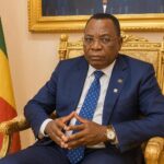
Observers often attribute Congo-Brazzaville’s steady diplomatic posture to the continuity provided by President Denis Sassou Nguesso, whose administration positions environmental diplomacy as a soft-power multiplier rather than a moral crusade. At the 2021 Glasgow climate summit, Brazzaville’s delegation secured multi-donor pledges for peatland conservation, citing data from the CongoPeat scientific consortium that the Cuvette Centrale stores up to 30 billion tonnes of carbon. Diplomats interviewed by this review underline that the government’s measured rhetoric—eschewing alarmism while foregrounding shared interests—has broadened support among both OECD and BRICS capitals.
Strategic Outlook Beyond the Horizon
Looking ahead, Congo-Brazzaville appears poised to translate its geographic assets into calibrated regional leadership. The planned bridge linking Brazzaville and Kinshasa, now backed by the African Union’s Programme for Infrastructure Development in Africa, could consolidate the twin-city agglomeration into the continent’s third-largest metropolitan market within two decades. Success, however, will hinge on sustaining macroeconomic prudence, maintaining inclusive urban governance and balancing ecological preservation with the monetisation of subsoil resources. In the measured words of a senior CEMAC official, “Brazzaville’s strength lies less in size than in situ—the republic sits at the hinge of Central Africa, and hinges, by nature, make larger doors move.”